NSK Map Collection
NSK Map Collection, one of four special collections of NSK, the National and University Library in Zagreb, holds all types of maps and atlases, among which the historical items and manuscript maps stand out as particularly valuable.
Holdings
The Collection’s resources include all types of maps – general and thematic maps, topographic maps at all scales, plans of cities and sea charts, historical, manuscript and celestial maps, and all types of atlases. Its around 42,000 sheet maps and nearly 2,000 atlases are organized in several thematic and chronological units divided into three main categories, i.e. historical and manuscript cartographic material, The Novak Collection and more recent cartographic resources.
Historical and manuscript cartographic material
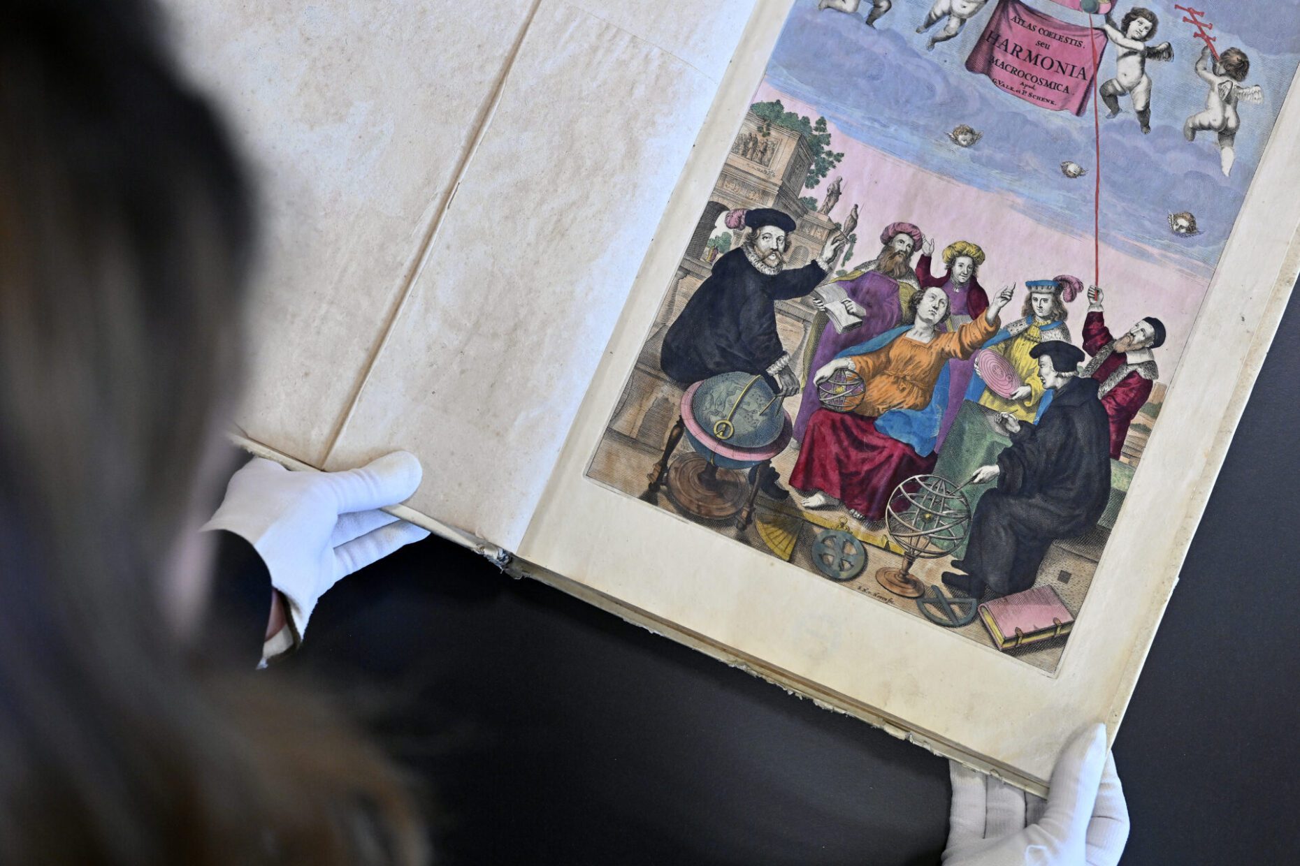
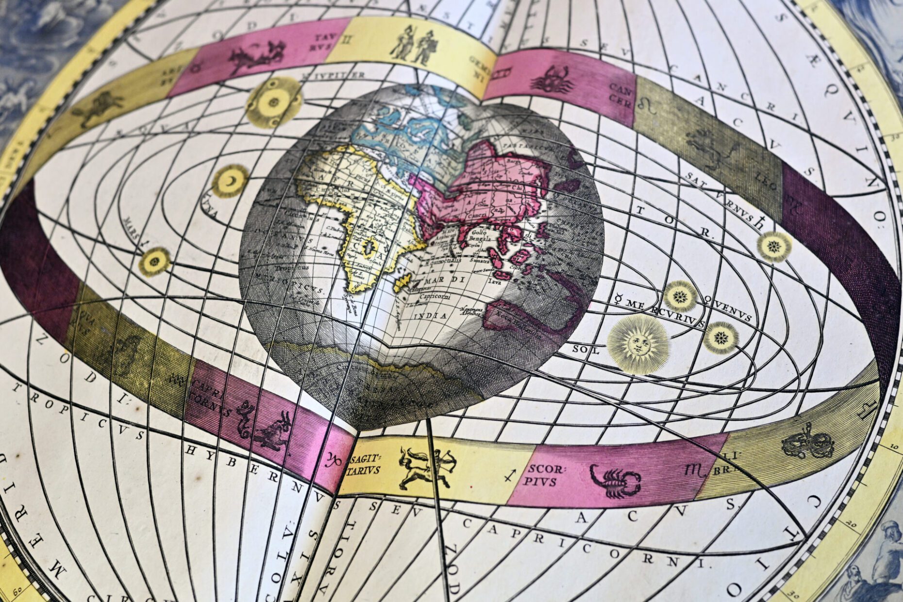
Andreas Cellarius. Harmonia macrocosmica, 1708.
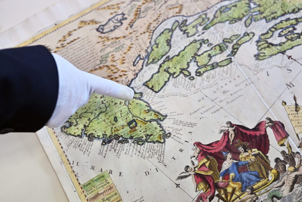
Representing the Collection’s greatest treasures, the woodcut and copperplate maps and atlases dating from the beginning of the 16th century to the mid-19th century include manuscript maps, drafts and plans comprising over 1,500 sheet maps and around one hundred atlases authored by the world’s greatest cartographers such as Gerardus Mercator, Abraham Ortelius, Joan Blaeu, Johannes Janssonius, Vincenzo Maria Coronelli and others.
Especially valuable are the atlases by Alexis-Hubert Jaillot, Johann Baptist Homann, Tobias Conrad Lotter, George Matthäus Seutter, Isolario by Benedetto Bordone, two editions of Geographiae by Claudius Ptolemy, a priceless 1806 manuscript atlas by Charles-François Beautemps-Beaupré popularly referred to as ‘Napoleon’s atlas’ and an exceptionally valuable collections of drafts and plans of the city of Osijek.
The Novak Collection
The Novak Collection, one of few, the most significant and richest Croatian cartographical collections, is preserved as part of the Collection. Compiled by Dr Drago Novak, Croatia’s notable 20th-century physician and scientist, but also a passionate researcher and collector of old maps, it contains valuable 16th-20th-centuries maps and prints documenting the regions of Croatia and its neighbouring countries, as well as some 200 book titles and atlases of recent date.
More recent cartographic resources
The Collection’s more recent resources comprise cartographic material dating from the mid-19th century to the present day. Exceptionally valuable in this category is the 19th-century collection of the maps of Croatia, plans of Zagreb, Croatia’s capital, and other Croatian cities, and the collections of the topographic maps of Croatia.
Reference collection
The Collection makes available an extensive reference collection comprising several hundred titles in the field of cartography and map librarianship.
Digital resources
The Collection’s digitised and born-digital resources are available on the NSK Digital Collections and NSK Digitised Cartographic Resources websites.
Digitisation requests
The Collection’s resources may be digitised upon request, for research purposes only. Digitisation requests may be submitted by filling out a request form and emailing it at kartografska@nsk.hr or in person, in the Collection’s reading room.
Opening hours
Monday – Friday 8.00 – 16.00
Holdings may be requested and consulted from 9.00 to 15.00.
Location
Floor 2