Rare 17th-century atlas added to treasures in NSK Map Collection

A rare 1687 atlas is the latest treasure in the Map Collection of the National and University Library in Zagreb (NSK).
Made by one of the most notable 17th-century cartographers, Franciscan Vincenzo Maria Coronelli (1650-1718), the atlas was printed in Paris by a prominent printer and engraver Nicolas Langlois. According to data included in it, the atlas was published in only 250 copies and only those who had previously purchased Coronelli’s globe could obtain it.
70 maps documenting the geography of the Great Turkish War
The valuable acquisition comprises as many as 70 maps and panoramas of which more than a half show the territory of present-day Dalmatia. They trace the geography of the 1684-1699 Great Turkish War which was unfolding in the Peloponnese (until the 14th century known as the Morea), Dalmatia, Herzegovina and the Bay of Kotor.
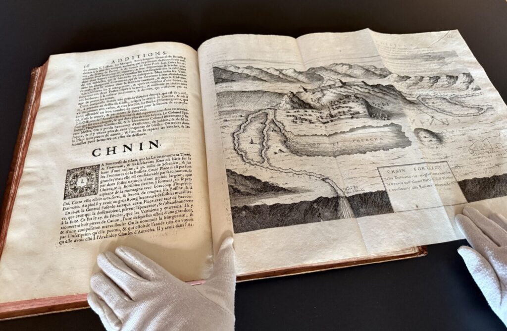
As a geographic record of this armed conflict between the Venetian Republic and Ottoman Empire, the maps show Venetian fortifications, towns and conquered territory, among which the historical Croatian cities Sinj and Knin (in the atlas termed Chnin) particularly stand out.